Groundwater Drought Indicator
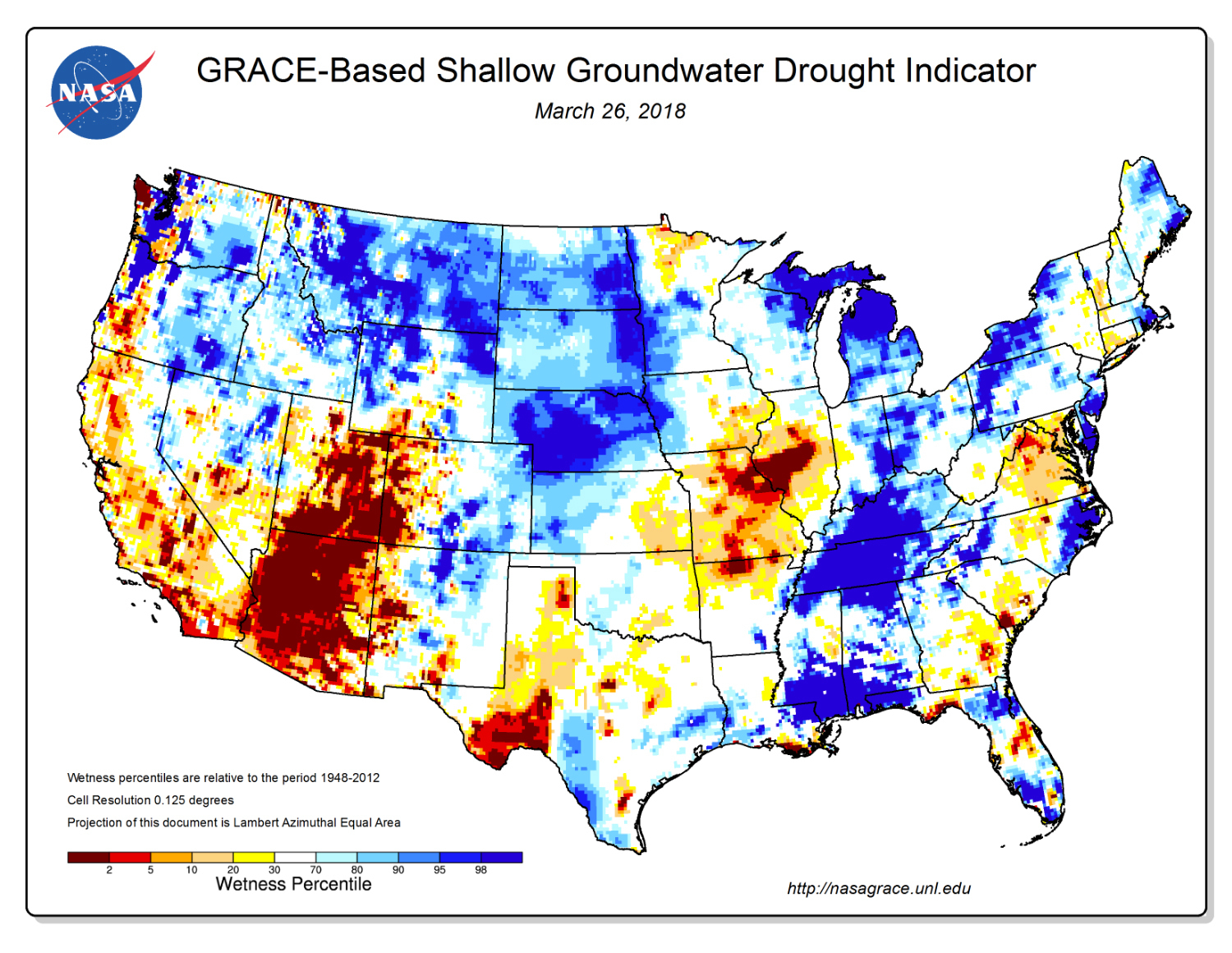
This map from September 2015 shows deep drought in California, Nevada and Texas. While the GRACE mission was active, scientists at NASA’s Goddard Space Flight Center generated groundwater and soil moisture drought indicators like this every week from GRACE data on terrestrial water storage and other observations, using a numerical model of land surface water and energy processes. They will resume producing maps when GRACE-FO data are available.
Credit
NDMC